
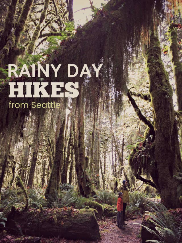
Are drizzly skies washing away your hiking plans? Some trails are best hiked in the rain! So go ahead and strap on those (waterproof) hiking boots–below are low-lying hiking trails that are glorious when pelted with rain and shrouded in mist.
We happen to live in a glorious temperate rain forest. With the right gear to keep you dry and a keen sense of curiosity about our unique ecosystem, you’ll find drizzly days are a wonderful opportunity to hit the trail. Some of these hikes meander alongside rivers that swell, tumble and churn more with rainfall, or pass gushing waterfalls that only dribble in summer. And still others are just more colorful and enchanting in wet weather when lichen is glistening, moss is spongier, cedar is more fragrant.
Essentials for Northwest Rain | Off-Season Hiking Safety Tips
Before you set off on one on these rainy day trails, keep in mind some off-season safety tips for the great outdoors. Dress in warm layers under rain gear, and avoid cotton altogether. Crossing streams is more dangerous when water is high and moving swiftly, so judge wisely if you should cross at all and use great caution if you do. Hike with sure footing as wet rocks, log bridges, boardwalk and mud on the trails can be quite slippery. And keep an eye on the time because it gets dark by late afternoon, or even earlier under a dense canopy of trees. Read more safety tips and know the ten essentials you should always pack in your backpack. Always check trail conditions before your hike by searching recent trip reports at wta.org.
![]()
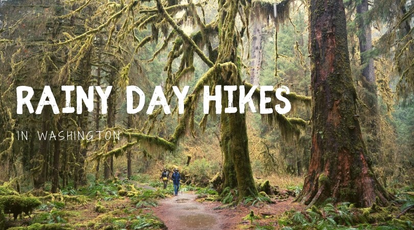
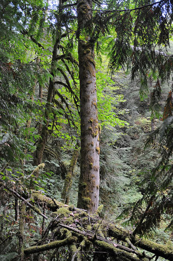
Hoh River Trail
Location: West side of the Olympic Peninsula south of Forks off Hwy 101
Contact: Olympic National Park, Hoh Visitor Center: 360-374-6925
Distance from Seattle: 169 miles (map + directions)
Great for: families, rain forest lovers, photographers
Hike stats: 10.5 miles round-trip, 300 feet elevation gain
Parking pass required: entrance fee $25 valid for 7 consecutive days, or an annual national park pass
Pitch a tent: The Hoh Campground is adjacent to the visitor center and trailhead, open year-round on a first-come, first-served basis (78 total sites, $20 nightly, water and toilets but no RV hookups).
Nearby digs: Two cute cabins–the Cedar Creek Cabin and Eagles Nest Chalet ($130-$175 nightly) are nestled in the woods beside the Bogachiel River and loaded with amenities like a full kitchen, heated floors, wifi and an outdoor firepit.
Hike this way: Holy Mosses! A whopping 140 inches of rain falls a year on this temperate rainforest trail that boasts some of the world’s biggest trees and spongiest moss, and the best time to hike it is indeed in the rain. For a spectacular all-day hike, take the flat, easy Hoh River Trail to Five Mile Island and back. For a quick shot of rainy wonder, two short interpretive trails, the Hall of Mosses (.75-mile loop) and the Spruce Trail, depart near the Visitors Center and lead you through a vibrant cathedral of ancient trees dripping with moss. As you step around licorice fern at your feet, be sure to keep an eye out for some of the Roosevelt elk that frequent these nature trails.
For more on this hike, check out Day Hiking: Olympic Peninsula by Craig Romano. Always pack the ten essentials on any hike.
Travel Alert: Road work on Highway 101 at Lake Crescent may result in 4-hour delays Mon-Thur 9am-1pm. More info.
![]()
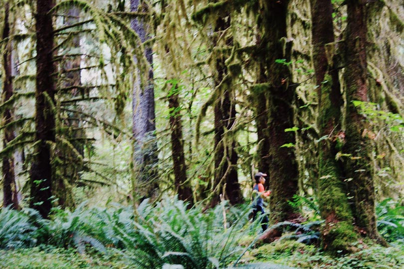
Quinault Rain Forest Nature Trails
Location: SW corner of Olympic National Park
Contact: Olympic National Forest National Forest, Pacific Ranger District: 360-288-2525
Distance from Seattle: 150 miles (map + directions)
Great for: moss spotters, tree huggers, families
Hike stats: up to 5 miles round-trip, no discernable elevation gain
Parking pass required: Yes, a Northwest Forest Pass is required at most trailheads.
Nearby digs: The rustic, craftsman-built Lake Quinault Lodge built in 1926 is steeped in history and surrounded by an emerald misty rain forest. My family prefers the Boathouse annex rooms best.
Hike this way: Lake Quinault is a perfect rainy weekend destination for folks who like really easy, really pretty hikes in very short bursts, interspersed with mugs of hot cocoa in front of a giant crackling fireplace in the lobby of the Lake Quinault Lodge. There are several trails around the lake that range in length from .5 to 5 miles, each offering an unforgettable taste of the unspoiled rain forest.
Several miles of inter-connected nature trails through rain forest can be accessed from the lake’s South Shore Road. You can pick up the trail at two of the forest service campgrounds in the area (Falls Creek or Willaby campgrounds) or from the Lake Quinault Lodge. Some stretches of the nature trails have interpretive signage. One stretch, the Quinault Rain Forest Nature Trail, is just .5 miles in length, while the Quinault Loop Trail is closer to five miles, allowing for a few good hours of easy hiking through this moist emerald paradise. If you park in the trailhead parking lots, your vehicle will need a Northwest Forest Pass.
On the lake’s north shore, don’t miss the stunningly beautiful Maple Glade Rain Forest Loop Trail / Kestner Homestead that departs from the Olympic National Park Quinault River Ranger Station and wends through a verdant boggy paradise for less than a mile.
For more on this hike, check out Day Hiking: Olympic Peninsula by Craig Romano. Always pack the ten essentials on any hike. Check trail conditions before your hike by searching recent trip reports at wta.org.
![]()
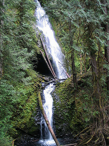 Murhut Falls
Location: Olympic Peninsula, Hood Canal
Contact: Olympic National Forest, Hood Canal Ranger District: 360-765-2200
Distance from Seattle: 74 miles (map + directions)
Hike stats: 1.6 miles round-trip, 300 feet elevation gain
Parking pass required: Yes, Northwest Forest Pass.
Book a platform tent: Play pioneer on the shores of Hood Canal in one of the white canvas wooden platform tents at Dosewallips State Park.
Hike this way: This short and sweet hike earns its reward–an enchanting 130-foot tiered waterfall–in just under a mile of easy walking, likely in solitude. Although Murhut Falls is not well known, it is well maintained, and the ascent is gentle enough for all ages as the trail was converted from an old logging road. The trail narrows in its final ascent to the falls and there’s a drop-off to one side, so hike with sure footing. This fern-fringed forest is pretty any time of year, but late spring offers a special enticement– beautiful blooming pink Pacific Rhododendrons!
For more on this hike, check out Day Hiking: Olympic Peninsula by Craig Romano or Best Hikes with Kids: Western Washington by Susan Elderkin.
![]()
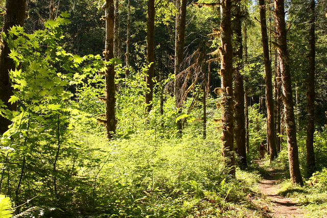
Old Sauk River
Location: Mountain Loop Highway near Darrington
Contact: Mount Baker Snoqualmie National Forest, Darrington Ranger District: 360-436-1155
Distance from Seattle: 79 miles (map + directions)
Hike stats: up to 6 miles round-trip, 150 feet elevation gain
Parking pass required: Yes, Northwest Forest Pass
Post hike grub: Whenever we’re hiking off the Mountain Loop, my family stops in for fries and milkshakes at Burger Barn (360-436-2070) in Darrington. Burgers are made to order, and everything is served in a basket.
Hike this way: The Old Sauk Trail just south of Darrington is an easy, flat trail that meanders alongside the beautiful Sauk River through an emerald mossy wonderland.
While not designated Wilderness, the Sauk River is designated a Wild and Scenic River and is protected critical habitat for spawning salmon and other critters, and the forest hasn’t been logged for nearly a century. Winter hikers are rewarded with large numbers of salmon-loving Bald Eagles who perch above the river where the living is easy. Spring brings forest-floor wildflowers like trillium, twinflower and carpets of dogwood, whereas autumn draws mushroom hunters in search of foragable fungi.
For details on this hike, check out Day Hiking: North Cascades by Craig Romano or Best Hikes with Kids: Western Washington by Susan Elderkin.
![]()
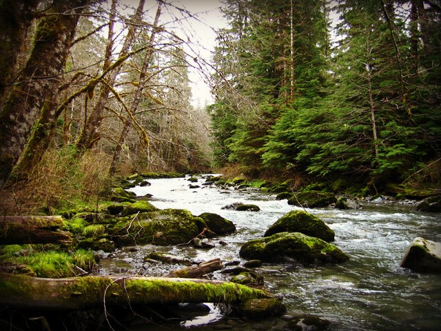
Boulder River
Location: North Cascades, SR 530 just east of Oso
Contact: Mount Baker Snoqualmie National Forest, Darrington Ranger District: 360-436-1155
Distance from Seattle: 70 miles (map + directions)
Great for: families, waterfall lovers, dogs on leash
Hike stats: 8.5 miles round-trip, 700 feet elevation gain
Parking pass required: No forest pass required here!
Hike this way: My favorite rainy day hike? Well since you asked, it’s this one! I never get tired of towering, moss-draped trees and pounding waterfalls, especially when gotten with very little effort.
Winding through one of the few remaining low-elevation, old-growth forests in the Cascades, the lush, seven-mile out-and-back hike passes sword ferns, old cedars, and several cliffside waterfalls that plunge into the trail’s namesake river. From the start your ears are filled with the sound of flowing, gurgling water, and this trail hugs beautiful Boulder River most of the way to the trail’s eventual dead end where you can lunch on a river bank, then turn around to retrace your steps and enjoy the waterfalls all over again.
For details on this hike, check out Day Hiking: North Cascades by Craig Romano or Best Hikes with Kids: Western Washington by Susan Elderkin.
![]()
 Lime Kiln Trail
Location: Robe Canyon Historic Park, off the Mountain Loop Highway just outside Granite Falls
Contact: Snohomish County Parks, 425-388-6600
Distance from Seattle: 45 miles (map + directions)
Hike stats: 7 miles round-trip, 625 feet elevation gain
Parking pass required: No.
Hike this way: Step into this mossy canyon where lush emerald ferns reach up to big-leaf maple, western-red cedar and Douglas fir.This easy trail follows the Stillaguamish River (“the Stilly” as locals call it) along the long-gone Everett & Monte Cristo Railway, built in the 1890s. Look for artifacts of the limestone mining era all along the trail, from moss-cloaked saw blades to a 20-foot-tall old lime kiln.
The well-signed trail starts in quiet forest and joins the Stilly about 1.5 miles in. From there it’s one more mile to the 20-foot tall old lime kiln, the highlight of the hike. This kiln is where calcium oxide was extracted from limestone for use in Everett industries. Turn around here or continue another mile to the trail’s end where a river bank vantage point invites you to look for spawning salmon.
For details on this hike, check out Day Hiking: North Cascades by Craig Romano.
PHOTOS: Old Sauk Trail by L.A. Catholique, Boulder River Trail by the-sillies via Flickr Creative Commons, Lime Kiln Trail by John Leszczynski, Hoh River Trail by Big Ben in Japan, Murhut Falls by Arpana Sanjay.