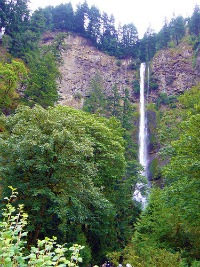
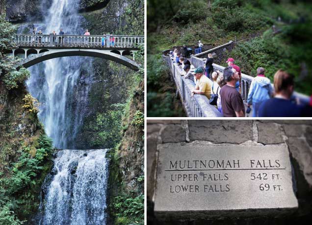
The 620-foot Multnomah Falls is the highest of the 77 named waterfalls on the Oregon side of the Gorge. And here’s another fun fact about this geologic wonder–it’s the second highest continually-flowing waterfall in the country.
The upper and lower falls that comprise Multnomah Falls are the first and most impressive cascades you will encounter on this loop hike, through the ten or so additional falls you’ll see are so pretty in their own right. No other hike in the Pacific Northwest (save for Silver Falls State Park’s waterfall loop trail) offers more cascading beauty for waterfall lovers.
Multnomah Falls – Wahkeena Falls Loop
Location: Columbia River Gorge National Scenic Area (map + driving directions)
Trail stats: 5.4 miles RT, 1550 feet elevation gain.
Contact: Multnomah Falls Visitor Center: (503) 695-2372
Begin at the popular trailhead for Multnomah Falls. In just a quarter mile, you’ll be standing on the historic Benson Bridge crossing Multnomah Creek between the two tiers of the falls. To get the full view, keep hiking up to the top of Multnomah Falls, a 600-foot climb from the parking lot.
You’ll notice most of the throngs of tourist hikers will turn around here. You will continue on, though, to the Wahkeena Loop Trail which eventually takes you past beautiful Wahkeena Falls then returns to the parking lot from which you started.
In between Multnomah and Wahkeena Falls are dozens of cascades to admire along the way (Ecoloa Falls, Fairy Falls, Dutchman Falls and more; ten of the waterfalls on this loop trail are named.)
Stay safe: Although this trail is hikeable year-round, dangerous ice can coat rocky parts of the trail in winter months, so hike with caution. As with any hike, you should have the ten essentials in your backpack.
photos: Multnomah Falls by slam szapucki, tourists at the falls by ChrisYunker.

